The basics
Wales is on the island of Great Britain, to the west of England, and covers an area of 20,782 square kilometres (8,024 square miles). That’s around half the size of the Netherlands, a similar size to Slovenia and slightly smaller than the US state of New Jersey.
Official estimates place the population of Wales at 3,135,000. The population density averages out at 150 people per square kilometre (290 per square mile), although there’s wide variation within the country. The population is heavily concentrated in the metropolitan areas around Swansea, Cardiff and Newport, the South Wales Valleys and the north-eastern corner.
Local knowledge
Since 1996, Wales has been divided into 22 local government areas, each with its own elected council. They vary considerably in size. Rural Powys, which includes much of the sparsely populated “Desert of Wales” (where you won't find any sands, but an expanse of moorland) is 47 times bigger than the county borough of Blaenau Gwent in the South Wales Valleys.
There are six official cities in Wales. Cardiff has been the capital since 1955, and is home to around 363,000 people. Swansea and Newport also have populations in the hundreds of thousands, while Bangor has just 19,000 residents. The last two, St Asaph and St Davids, are the two smallest cities in the UK, with populations of around 3,500 and 2,000 respectively.
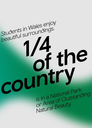
Much of Wales’ landscape is protected, ensuring its beauty will be preserved for generations to come. Around a quarter of the country lies either within one of its three National Parks (Snowdonia, the Brecon Beacons and the Pembrokeshire Coast) or one of its five Areas of Outstanding Natural Beauty (AONBs): the Llŷn Peninsula, the Clwydian Range and Dee Valley, the Gower Peninsula, Anglesey and the Wye Valley.
Mountains and sea
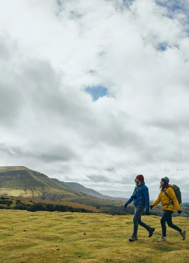
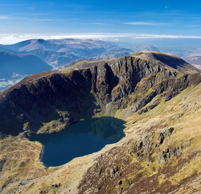
It has been said that if Wales were flattened out, it would be bigger than England – and there’s more than a pebble of truth to the joke. Move inland from the coastal plains of South or West Wales and you’ll soon reach the valleys, hills and mountains that make up most of the country.
The Snowdonia National Park, in North West Wales, contains the greatest of the mountain ranges. It takes its name from Snowdon, known as Yr Wyddfa in Welsh – Wales’ tallest summit at 1,085m (3,560ft) above sea level. The other major range is the Brecon Beacons in South Wales. Its highest summit is the 886m (2,907ft) Pen y Fan.
The coastline is as magnificent as the mountains, and Wales is the first country in the world to have a dedicated footpath that follows its whole coastline – a total of 1,400km (870 miles). There are around 50 islands, ranging in size from Anglesey (the seventh-largest of the British Isles) to lonely, uninhabited outcrops.